
CHE University Ranking
Filter for projects
Geography, Department
Mathematisch-Naturwissenschaftliche Fakultät
Rheinische Friedrich-Wilhelms-Universität Bonn
Mathematisch-Naturwissenschaftliche Fakultät
Fachgruppe Erdwissenschaften - Geographisches Institut
Meckenheimer Allee 166
D-53115 Bonn
Telephone: +49 228 73-7290
https://www.uni-bonn.de
Uni Bonn
Department on the internet
Online application
Student body
Fachgruppe Erdwissenschaften - Geographisches Institut
Meckenheimer Allee 166
D-53115 Bonn
Telephone: +49 228 73-7290
https://www.uni-bonn.de
Uni Bonn
Department on the internet
Online application
Student body
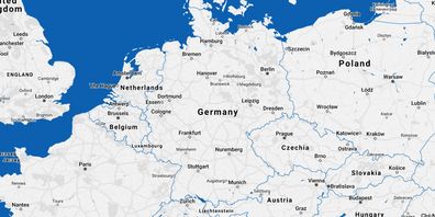
Map material from the free geographic information system OpenStreetMap. The DAAD explicitly does not adopt the information provided there (names, boundaries, etc.) in every case. No guarantee is given for the accuracy of this information.
Legend:
- Department
Basic information
- Total number of students at the department
1,360
- Number of master degree students (w/o teacher qualification)
560
- Percentage of teaching by practitioners
14.3%
- Percentage of teaching by practitioners, master's
8.2%
Support during the study entry phase
- Total score for support in the study entry phase
11/14 points
Job market- and career-orientation
- Bachelor theses in cooperation with work environment
48.2%
- Master theses in cooperation with work environment
52.8%
Research
- Publications per academic
2.3
- Third party funds per academic
65,800 €
- Doctorates per professor
0.8
- Research reputation
51.3%
Students' assessments on undergraduate, presence-learning-courses
- Teacher support
- Support in studies
- Courses offered
- Study organisation
- Exam organisation
- Excursions
- Research orientation
- Offers for career orientation
- Support for stays abroad
- Rooms
- Library
- IT-infrastructure
- Overall study situation
- Return rate of the questionnaires
81
Further information provided by the department
Special features regarding teaching
Close links between research and teaching, i.e. high reference and gradual introduction of students to research-oriented topics; integration of theory and practical phases through high proportion of project work, therefore highly practice-related in combination with excellent methodology training; applied issues from professional life due to commitment of lecturers from the field; wide range of choices in study programme, courses taught in English too; optimal guidance and support services by the study programme manager; opportunities for the acquisition of key skills (including languages, GIS)
Exchange universities for stay abroads
University College London, GB; University of Bristol, GB; University College Cork, Irland; Université de Paris-Sorbonne, Frankreich; University of Bergen, Norwegen; University of Amsterdam, Niederlande; University of Prag, Tschechien; University of Iceland, Island; Universität Wien, Österreich; Universidad de Granada, Spanien
Special features regarding the equipment
WiFi in all public areas of the institute. Individual access to the university network possible, access via EDUROAM/VPN. Digital communication via Infomonitor and usual social media channels. Equipment of the seminar rooms with multimedia technology; online teaching possible; multi-media laboratory for the production of e-learning modules. Laboratories e.g. for water and soil analysis for research and teaching, testing grounds for field trials. Online research in collections is possible from any location. 2 computer pools with 31 and 14 seats respectively for teaching and self-study; 20 laptops for mobile use.
Special features regarding research activities
Geographical research fundamentally focusses on three characteristic points: Water, Risk, Geomatics. Within the framework of this profile focus, 9 scientific areas (climatology/landscape ecology, hydrology/water resource management, geomorphology, geographic development research, urban and regional geography, economic and social geography, historical geography, remote sensing/GIS, subject didactics) form the research and teaching portfolio. Cooperations in the field: Medical geography, aquatic ecology, conservation, and ABC/J geo association.
Legend
Groups
green
yellow
blue
not specified
Acronyms
(S) = Students' judgements
(F) = Facts
(P) = Professors' judgements
Units
Value in percent
Value in points
Euro
Thousand Euro
Last Update 2021: Data collected by the
CHE Center for Higher Education
